LaunchToCosmos
Voltar às notícias
NASA OFICIAL

Honey Prairie Fire, Georgia, U.S.

Honey Prairie Fire, Georgia, U.S.

29 de julho de 2026
há cerca de 1 hora
Honey Prairie Fire, Georgia, U.S.
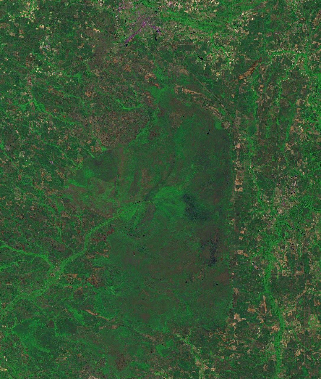
before
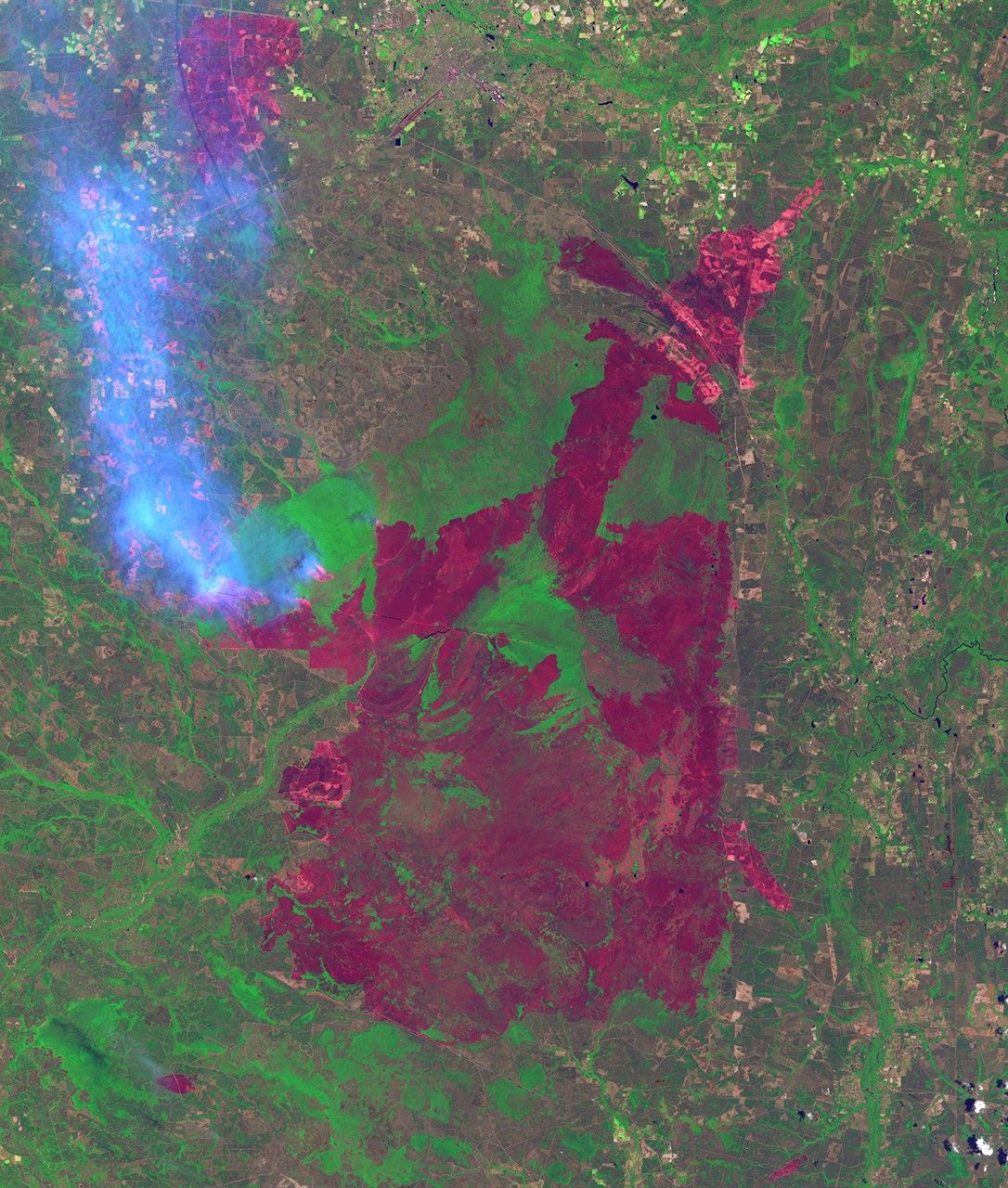
after
Lightning sparked wildfires near the Okefenokee National Wildlife refuge in the Honey Prairie region of Georgia, US, on April 30, 2011, after the left-hand image was taken. Dry conditions helped fuel the fires and continued lightning strikes started new ones. By July 7, over 290,000 acres had burned.

Before and After

Honey Prairie Fire, Georgia, U.S.

April 30, 2011 - July 3, 2011

Lightning sparked wildfires near the Okefenokee National Wildlife refuge in the Honey Prairie region of Georgia, US, on April 30, 2011, after the left-hand image was taken. Dry conditions helped fuel the fires and continued lightning strikes started new ones. By July 7, over 290,000 acres had burned. The red tones of the July 3 image represent recovering vegetation in previously burned areas. Light tones are the smoke of active fires. Images taken by the Thematic Mapper sensor aboard Landsat 5. Source: USGS Landsat Missions Gallery, "Honey Prairie Fires," U.S. Department of the Interior / U.S. Geological Survey.
Downloads

Image 1

JPEG

(5 MB)

Image 2

JPEG

(4 MB)

NASA

Agência Espacial Americana

Fonte original