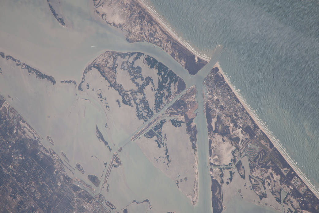
ISS038-E-57806 (21 Feb. 2014) — One of the Expedition 38 crew members aboard the International Space Station photographed this image of the Gulf of Mexico’s Intracoastal Waterway in southern Texas. Represented in the photo are 18 kilometers (11.2 miles) of the overall 4800 kilometers-long (3000 miles) barge channel that lies on the protected inshore of the coastal islands of the southern and eastern USA, including coastal Texas. The small city of Port Aransas lies on a barrier island fully 18 kilometers (11.2 miles) seaward of the mainland and its sister city, Aransas Pass (lower left). This image shows parts of the waterway that are artificial, as in the straight sector leading into Corpus Christi Bay. Corpus Christi lies outside the lower margin of the image. Other sectors of the waterway are natural bays such as Aransas Bay. Jetties protect the inlet into the Gulf of Mexico (top right). Inlets at many points cut through the barrier islands to give shipping access to the Gulf of Mexico and the Atlantic Ocean.