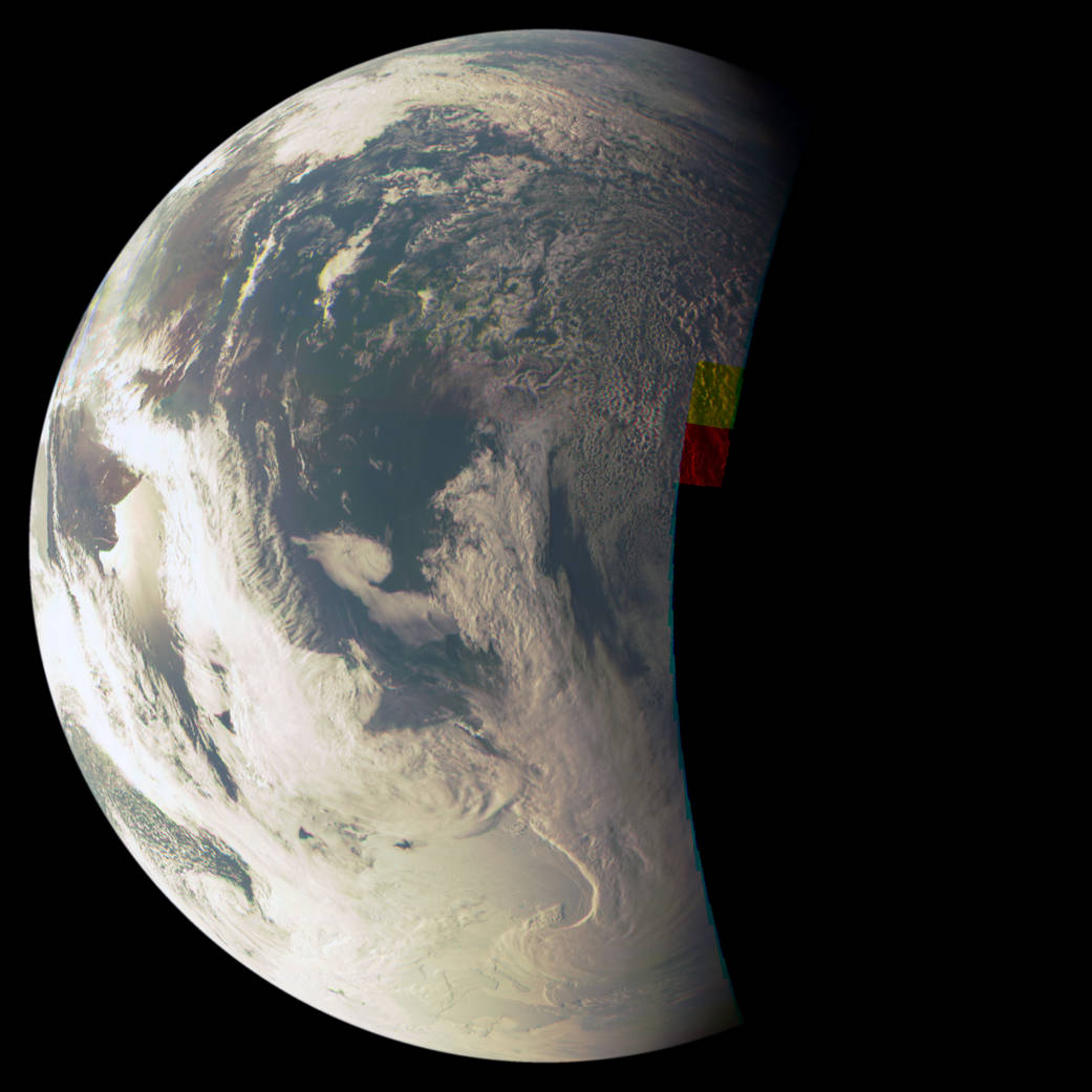
This image of Earth was taken during the close flyby of NASA’s Juno spacecraft on October 9, 2013. The image was acquired at 19:12 UT at an altitude of 1,987 miles (3,197 kilometers) – just 10 minutes before Juno’s closest approach to our planet.
The image is a combination of the JunoCam instrument’s red, green and blue spectral filters and approximates natural color. The image is a mosaic of 82 individual frames taken as the spacecraft spun; the constituent images were composited and remapped by Juno scientists Mike Caplinger and Mike Ravine of Malin Space Science Systems, which built and operates the JunoCam instrument for NASA.
The image provides a view of the Argentinean coastline at upper left, with reflections, or specular highlights, off the Rio Negro, north of Golfo San Matias. Clouds cover much of Antarctica at bottom.
Image credit: NASA/JPL-Caltech/MSSS