before
after
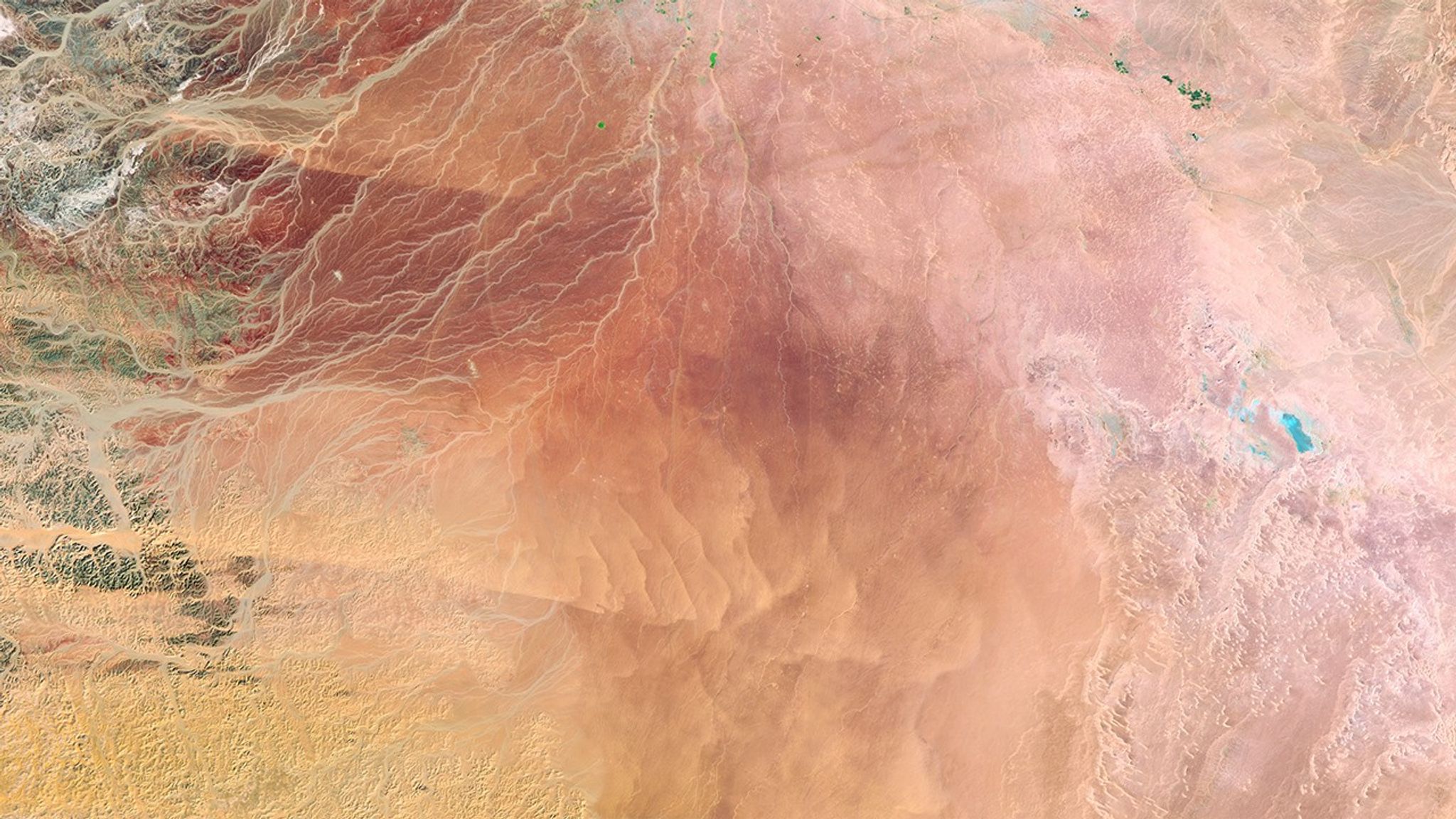
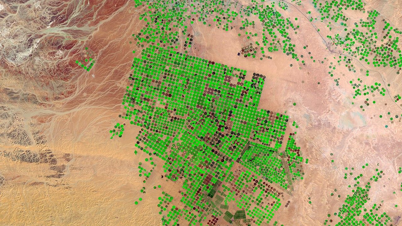
Water lying deep beneath the sand for thousands of years has enabled Saudi Arabia to transform desert in the Wadi As-Sirhan basin into productive farms. Some of the green fields seen here—circular because each is irrigated with a sprinkler system that rotates around the field like the hands of a clock sweep around the clock’s face—are as large as 1 kilometer (about two-thirds of a mile) across. But the region’s rainfall is too little to recharge the aquifer and hydrologists estimate that pumping will be feasible for only another 50 years. Farmers are encouraged to switch to more sustainable methods, such as greenhouse farming with drip irrigation. 1986 image: Landsat 5. 2016 image: The Operational Land Imager onboard Landsat 8. Source: U.S. Geological Survey (USGS) Landsat Missions Gallery; U.S. Department of the Interior / USGS and NASA.
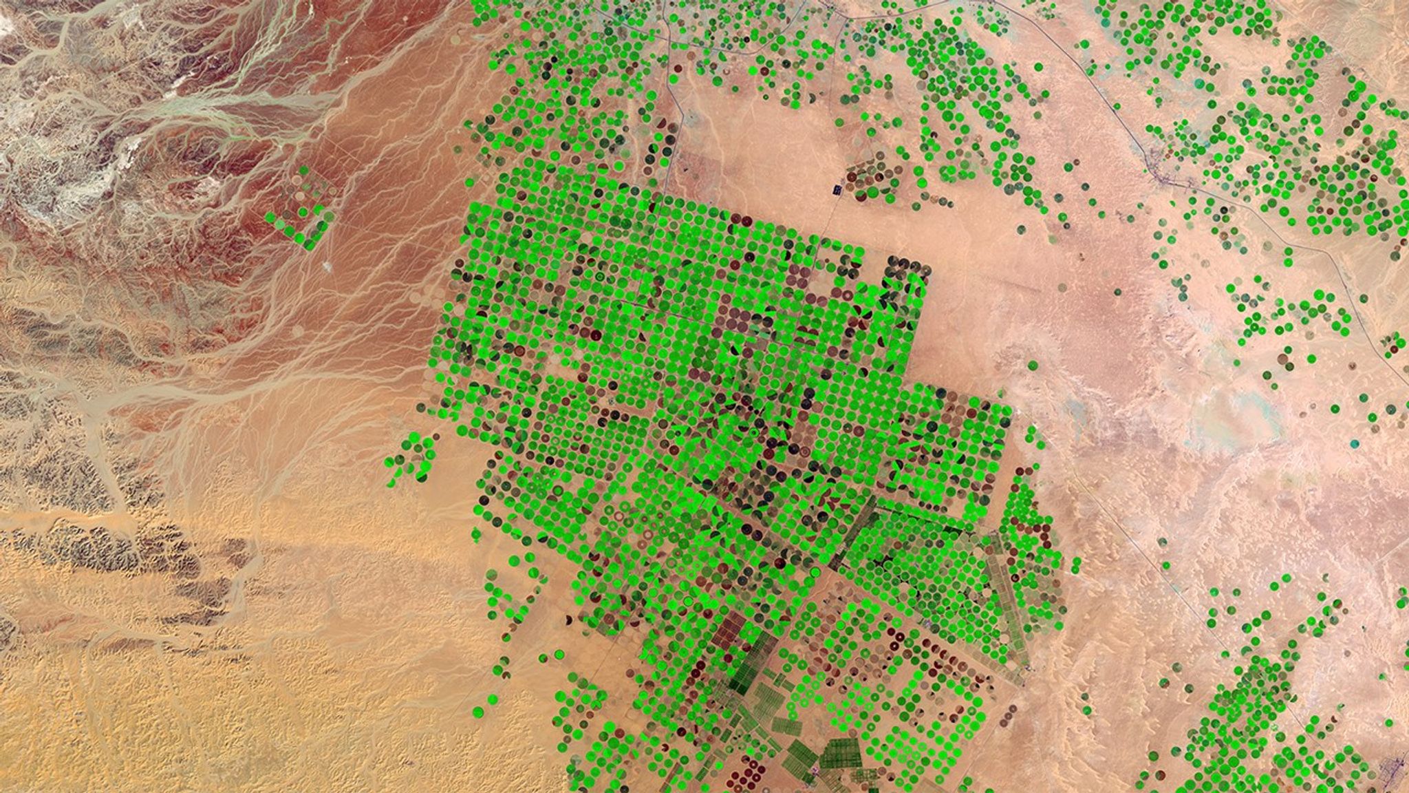
Water lying deep beneath the sand for thousands of years has enabled Saudi Arabia to transform desert in the Wadi As-Sirhan basin into productive farms. Some of the green fields seen here—circular because each is irrigated with a sprinkler system that rotates around the field like the hands of a clock sweep around the clock’s face—are as large as 1 kilometer (about two-thirds of a mile) across. But the region’s rainfall is too little to recharge the aquifer and hydrologists estimate that pumping will be feasible for only another 50 years. Farmers are encouraged to switch to more sustainable methods, such as greenhouse farming with drip irrigation. 1986 image: Landsat 5. 2016 image: The Operational Land Imager onboard Landsat 8. Source: U.S. Geological Survey (USGS) Landsat Missions Gallery; U.S. Department of the Interior / USGS and NASA.
Before and After
Wadi As-Sirhan agricultural growth, Saudi Arabia
February 2, 1986 - February 21, 2016
Water lying deep beneath the sand for thousands of years has enabled Saudi Arabia to transform desert in the Wadi As-Sirhan basin into productive farms. Some of the green fields seen here—circular because each is irrigated with a sprinkler system that rotates around the field like the hands of a clock sweep around the clock’s face—are as large as 1 kilometer (about two-thirds of a mile) across. But the region’s rainfall is too little to recharge the aquifer and hydrologists estimate that pumping will be feasible for only another 50 years. Farmers are encouraged to switch to more sustainable methods, such as greenhouse farming with drip irrigation. 1986 image: Landsat 5. 2016 image: The Operational Land Imager onboard Landsat 8. Source: U.S. Geological Survey (USGS) Landsat Missions Gallery; U.S. Department of the Interior / USGS and NASA.