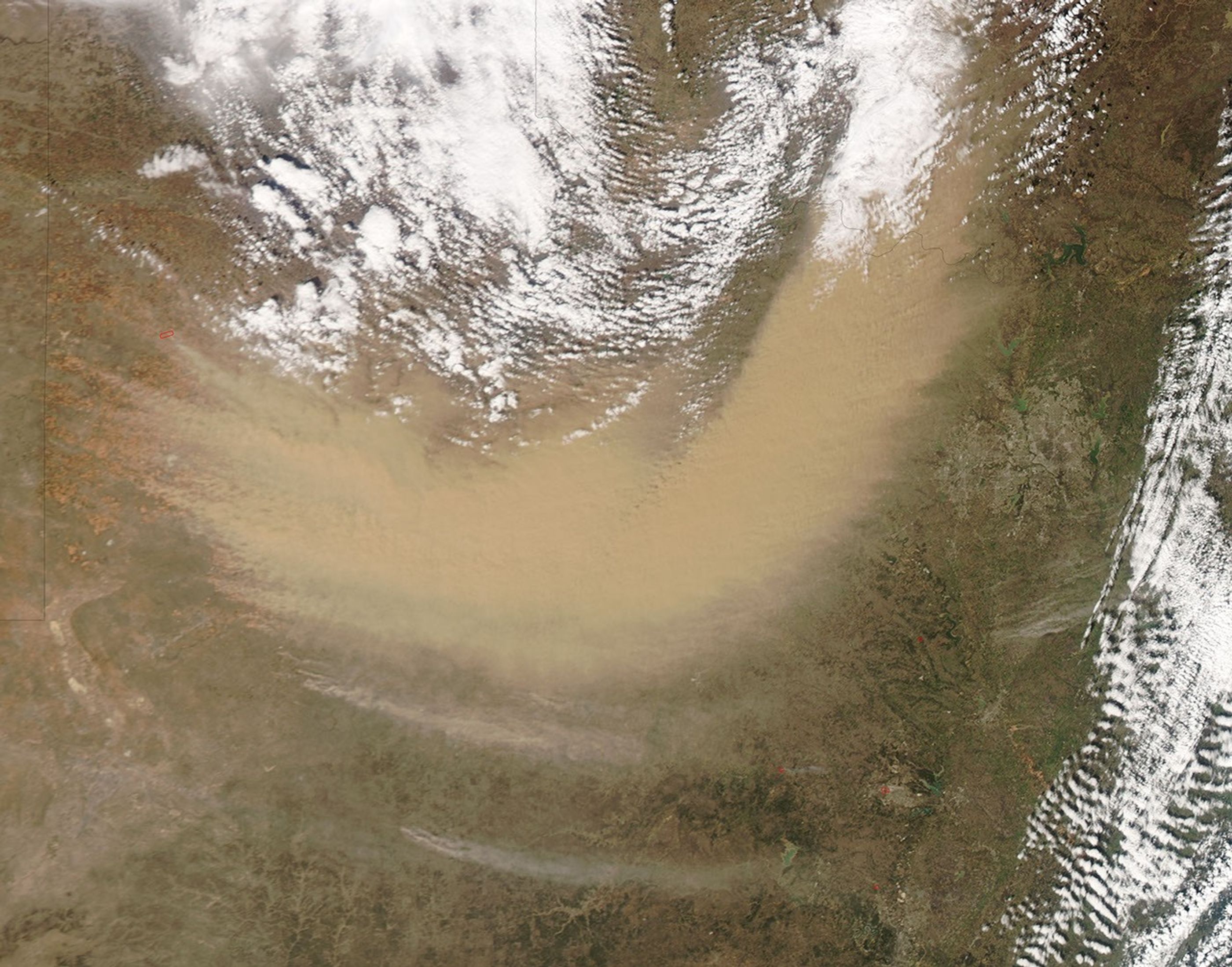
High winds wreaked havoc across northern Texas on February 24, 2007. According to Dallas Morning News and Houston Chronicle, downed power lines left some 37,000 homes and businesses without electricity while gusts up to 100 kilometers (60 miles) per hour fueled grass fires and kicked up dust.
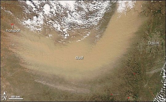
The Moderate Resolution Imaging Spectroradiometer (MODIS) on NASA’s Aqua satellite took this picture of northern Texas on February 24, 2007. This image shows a boomerang-shaped plume of dust sweeping across the state, narrowly missing the Dallas metropolitan area to the east. Source points for the dust storm appear along the western edge of the plume, along with a hotspot where MODIS detected anomalously warm surface temperatures, likely from a grass fire. Smaller hotspots also appear south of Dallas.
According to news reports, blowing dust reduced visibility to less than a mile in some Texas locations, and caused the cancellation of roughly 300 flights at Dallas-Forth Worth International Airport. Fires spread by the storm destroyed three homes and forced the evacuation of the Fort Hood army base.
References & Resources
NASA image by Jeff Schmaltz, MODIS Rapid Response Team, Goddard Space Flight Center.