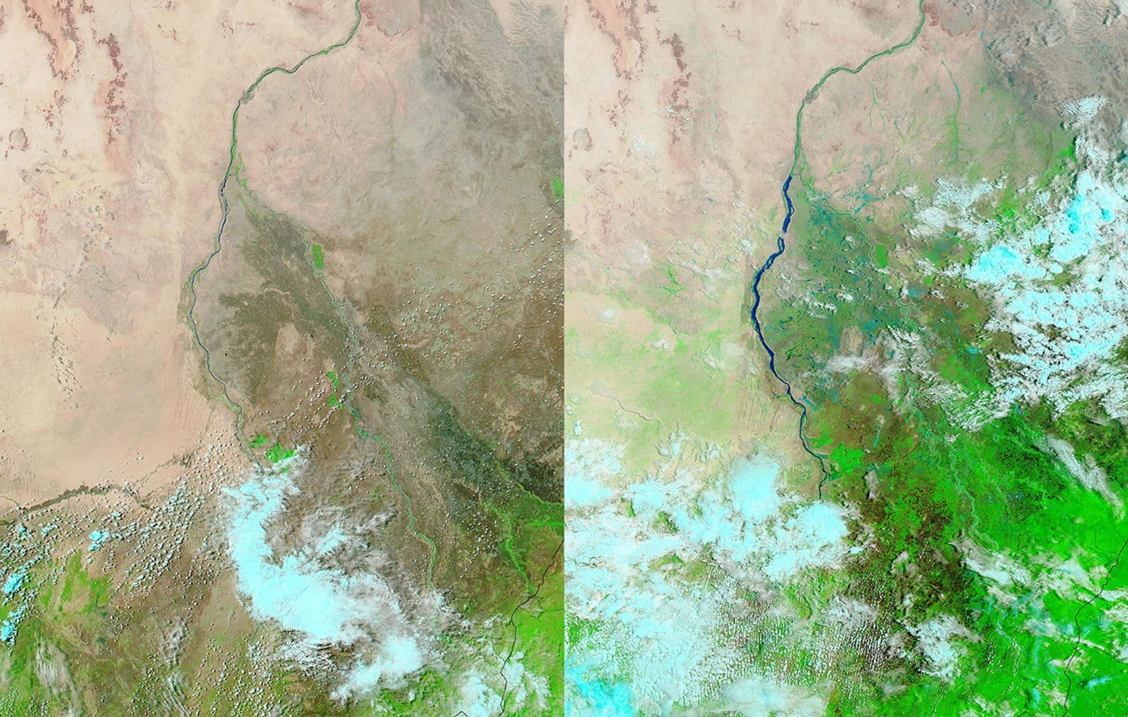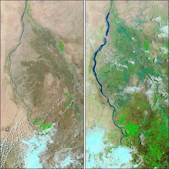
Heavy rains in Sudan flooded the White Nile between August 3-11, 2003. This pair of images from the Moderate Resolution Imaging Spectroradiometer (MODIS) on the Terra (right) and Aqua (left) satellites shows the river on June 19 (left) and August 11 (right), swollen from rains. The area between the White Nile and the Blue Nile to the east is dotted with pools of standing water as well. In these images, water is blue, vegetation is bright green, naturally bare soil and low vegetation are tan and drab green, and clouds are light blue and white. The flooding has displaced 13,000 people, leaving more than 3,000 homeless, and destroying crops.
The high-resolution image provided above is 500 meters per pixel. The MODIS Rapid Response System provides these images at MODIS? maximum spatial resolution of 250 meters: Jun. 19 and Aug. 11.
References & Resources
Image courtesy Jacques Descloitres, MODIS Rapid Response Team at NASA GSFC