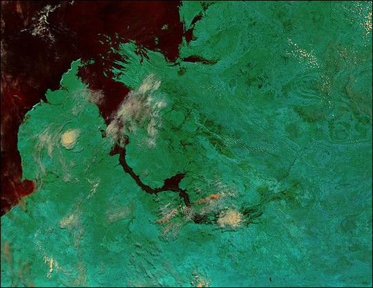
Though waters have receded a bit from last week’s levels, the Fitzroy River in northwestern Australia continues to overflow its banks. The false-color image of the flood was acquired on March 3, 2002, by the Moderate-resolution Imaging Spectroradiometer (MODIS), flying aboard NASA’s Terra spacecraft.
The flooding began a week and a half ago when roughly 300 mm of rain poured down on the region in a four-day period. The water swept over the normally dry landscape and mostly drained into the Fitzroy River, which forms a swollen black crescent in the middle of the image. Additional flooding can be seen just north of the river and around King Sound, which is the bay that the river runs into. During the dry season the river resembles a thin black line.
In this false-color image, green shows land surface and black is water. The pinkish-white patches are clouds. To obtain copies of this image in true color, visit the MODIS Rapid Response Image Gallery.
References & Resources
Image courtesy Jacques Descloitres, MODIS Land Rapid Response Team at NASA GSFC