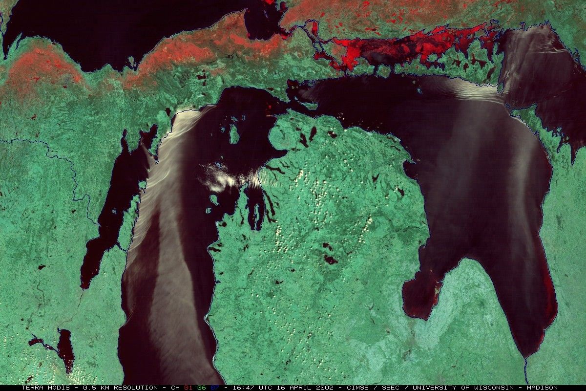

A southerly flow of unseasonably warm, moist air (temperatures of +20° to +26° C,dew points of +14° to +16° C) over the relatively cool (generally +2° to +5° C )water of Lake Michigan and Lake Huron contributed to the development of largeadvection fog plumes (caused by the horizontal motion of air) during the day on April 16, 2002. These fog plumes movednorthward during the day, eventually interacting with various land features toproduce patterns of wave diffraction and packets of reflected waves (resembling#8220;shock waves”) as the fog plumes impinged upon the rugged coastlineof Wisconsin, the Upper Peninsula of Michigan, and Ontario. These waves remainedtrapped within the strong marine layer temperature inversion which was sustainedby the continued flow of warm air across the cool water surface.
The above image was acquired by the Moderate-Resolution Imaging Spectroradiometer(MODIS) aboard NASA’s Terra satellite. Red = .645µm (red),green = 1.627µm, (shortwave infrared), blue = 2.13µm (shortwave infrared).
References & Resources
Image courtesy Space Science and Engineering Center, University of Wisconsin