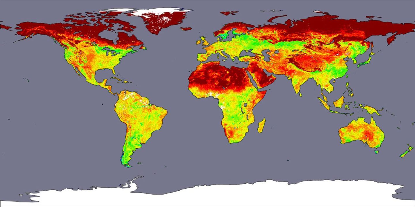
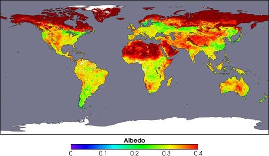
A new sensor aboard NASA’s Terra satellite is now collecting the most detailed and accurate measurements ever made of how much sunlight the Earth’s surface reflects back up into the atmosphere. By quantifying precisely our planet’s reflectivity, or albedo, the Moderate Resolution Imaging Spectroradiometer (MODIS) is helping scientists better understand and predict how various surface features influence both short-term weather patterns as well as longer-term climate trends. (Click to read the press release.)
The colors in this image emphasize the albedo over the Earth’s land surfaces, ranging from 0.0 to 0.4. Areas colored red show the brightest, most reflective regions; yellows and greens are intermediate values; and blues and violets show relatively dark surfaces. White indicates where no data were available, and no albedo data are provided over the oceans. This image was produced using data composited over a 16-day period, from April 7-22, 2002.
References & Resources
Image courtesy Crystal Schaaf, Boston University, based upon data processed by the MODIS Land Science Team