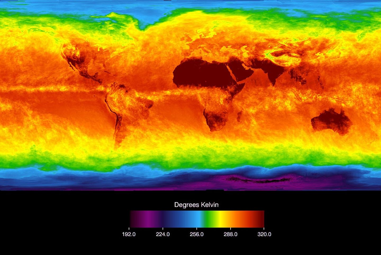
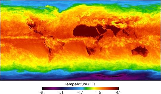
The Atmospheric Infrared Sounder (AIRS) instrument aboard NASA’s Aqua satellite sensestemperature using infrared wavelengths.This image shows temperature of the Earth’s surface or clouds coveringit for the month of April 2003. The scale ranges from -81 degrees Celsius (-114° Fahrenheit) inblack/blue to 47° C (116° F) in red. The Intertropical Convergence Zone,an equatorial region of persistent thunderstorms and high, cold cloudsis depicted in yellow. Higher latitudes are increasingly obscured byclouds, though some features like the Great Lakes are apparent.Northernmost Europe and Eurasia are completely obscured by clouds, whileAntarctica stands out cold and clear at the bottom of the image.
References & Resources
Image courtesy AIRS Science Team, NASA/JPL