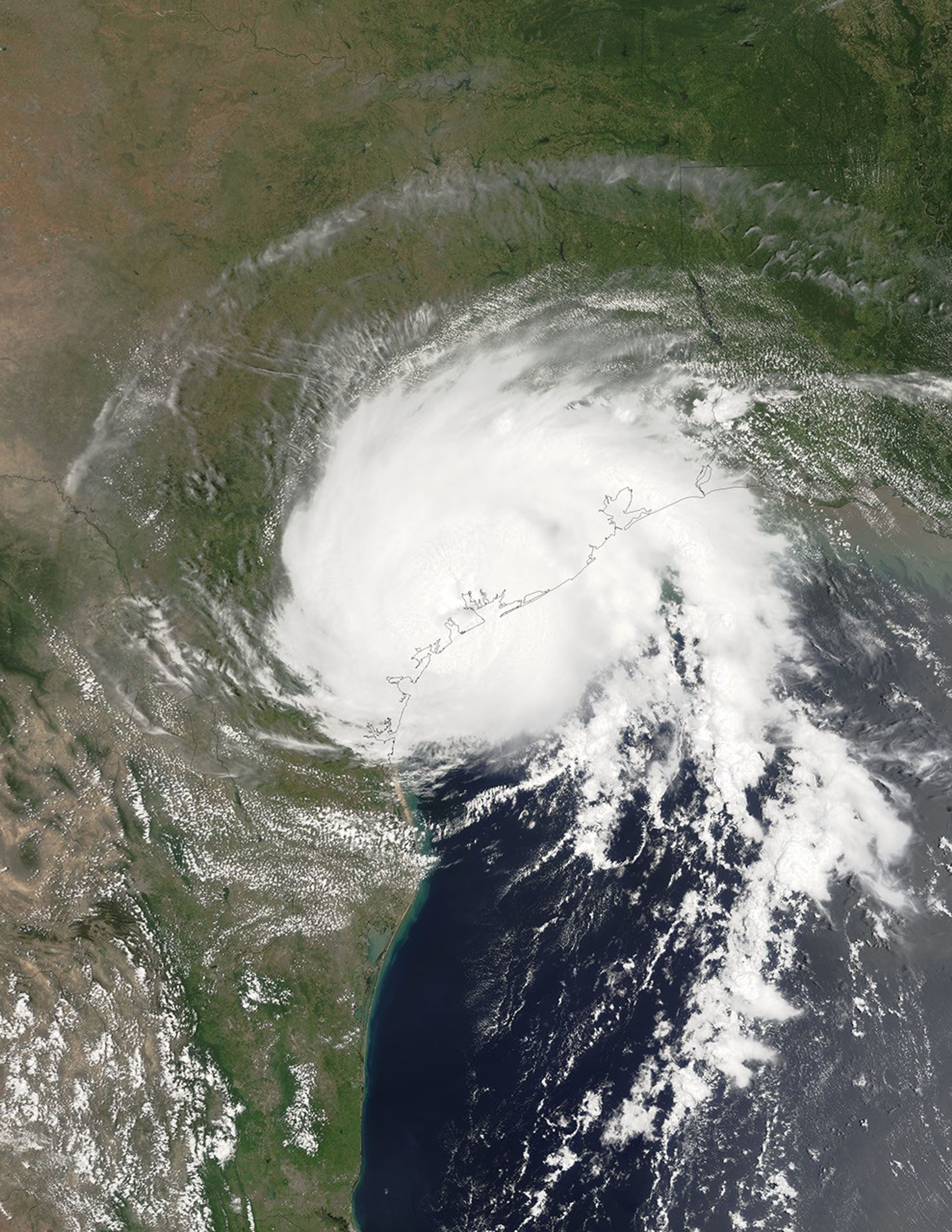
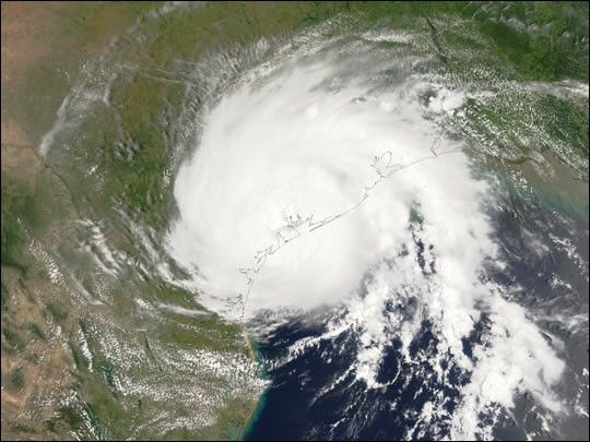
On July 15, 2003, at 12:55 EDT, the Moderate Resolution Imaging Spectroradiometer(MODIS) instrument onboard NASA’s Terrasatellite captured this bird’s-eye view of Hurricane Claudette makinglandfall at Matagorda Bay on the middle Texas coast. At the time of thisimage, Claudette was packing maximum sustained winds of 80 mph (129 km per hour) with slightlyhigher gusts, classifying the storm as a Category 1 hurricane on theSaffir-Simpson scale. Claudette is expected to dump as much as 10 inches ofrain in portions of Texas and Louisiana, and to produce storm surge flooding of4 to 6 feet above normal tide levels. As Claudette moves inland, she willweaken rapidly, but will continue to dump copious amounts rain tonight andtomorrow.
References & Resources
Image courtesy Liam Gumley, University of Wisconsin-Madison Space Science and Engineering Center