- Temperature (1.0 MB JPEG)
- Vegetation (1.0 MB JPEG)
As many urbanites know, summertime has its downside. The things we take for granted in cities—roads, sidewalks, brick buildings, and asphalt roofs—all intensify summer heat by trapping the Sun’s energy and remaining warm long after the Sun has set. This phenomenon has a name: urban heat island. In summer 2002, Stuart Gaffin of Columbia University and his colleagues used satellite temperature data, city-wide land cover maps, and weather data, along with a regional climate model to identify the best strategies for cooling Gaffin’s hometown, New York City.
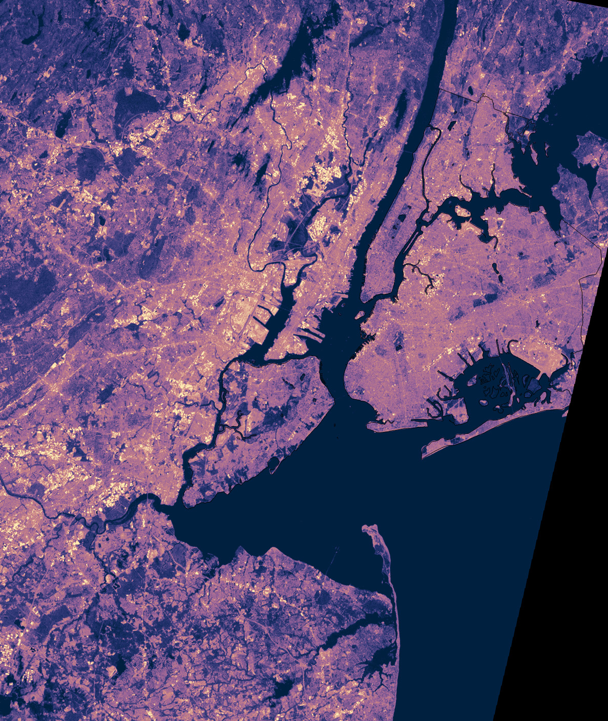
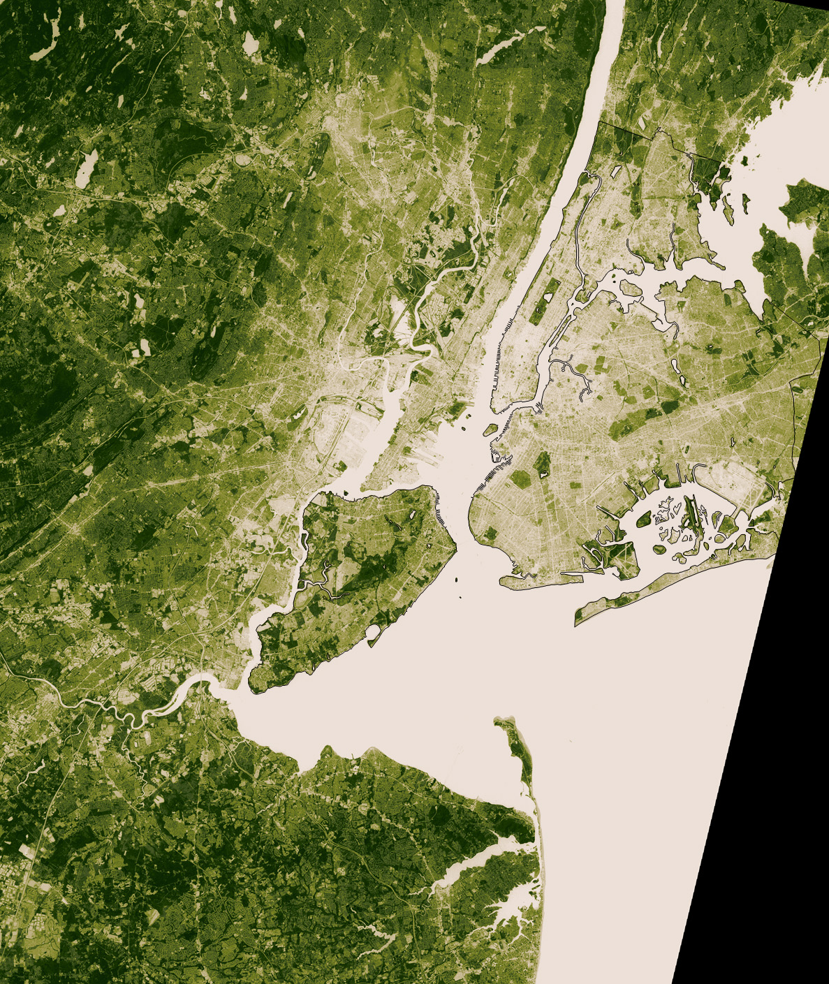
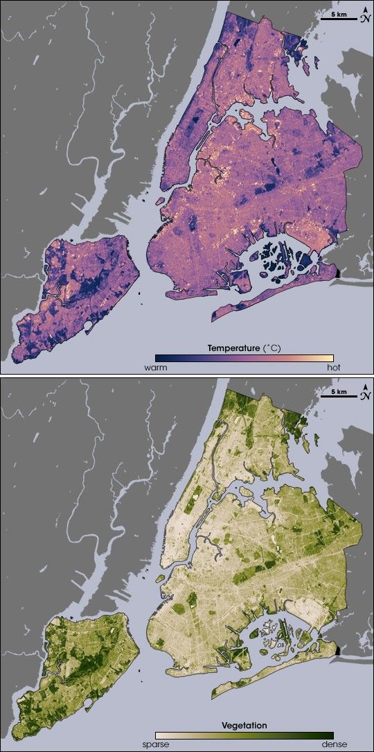
As part of the study, the team used thermal infrared satellite data measured by NASA’s Landsat Enhanced Thematic Mapper Plus on August 14, one of the hottest days in New York’s 2002 summer. Landsat also collected vegetation data. The top image shows temperature, ranging from blue (warm) to yellow (hot). The bottom image shows vegetation from beige (sparse) to deep green (dense). A comparison of the images shows that where vegetation is dense, temperatures are cooler. Urban heat islands are worst where there is little or no vegetation.
By carefully examining the relationship between city surfaces, temperature, and energy use, Gaffin and his colleagues concluded that urban forestry and vegetation-covered roofs could lower city temperatures and even reduce the demand for air conditioning and the consumption of electricity. To learn more about how NASA scientists evaluated different strategies for reducing New York’s urban heat island, please read the Earth Observatory feature story Beating the Heat in the World’s Big Cities.
- Related reading:
- Rosenzweig, C., Solecki, W., Parshall, L., Gaffin, S., Lynn, B., Goldberg, R., Cox, J., and Hodges, S. (2006) Mitigating New York City’s heat island with urban forestry, living roofs, and light surfaces. (PDF document, 108 KB) Presentation at 86th American Meteorological Society Annual Meeting, January 31, 2006, Atlanta, Georgia.
- Keeping New York City “cool” is the job of NASA’s “heat seekers” (2006) from NASA Goddard Institute for Space Studies. Accessed July 31, 2006.
References & Resources
Maps by Robert Simmon, using data from the Landsat Program.