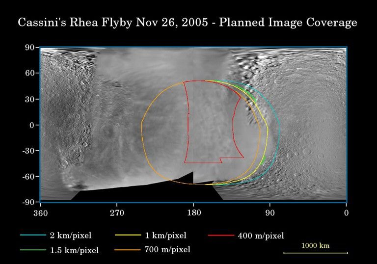
This map of the surface of Saturn's moon, Rhea, illustrates the regions that will be imaged by Cassini during the spacecraft's close flyby of the moon on Nov. 26, 2005. At closest approach, the spacecraft is expected to pass approximately 500 kilometers (310 miles) above the moon's surface.
This map of the surface of Saturn's moon, Rhea, illustrates the regions that will be imaged by Cassini during the spacecraft's close flyby of the moon on Nov. 26, 2005. At closest approach, the spacecraft is expected to pass approximately 500 kilometers (310 miles) above the moon's surface
Rhea Flyby at a Glance
Date
Nov. 26, 2005
Distance
310.7 miles (500 km)
Speed
16,330 mph (7.3 km/sec)