
May 18, 2004
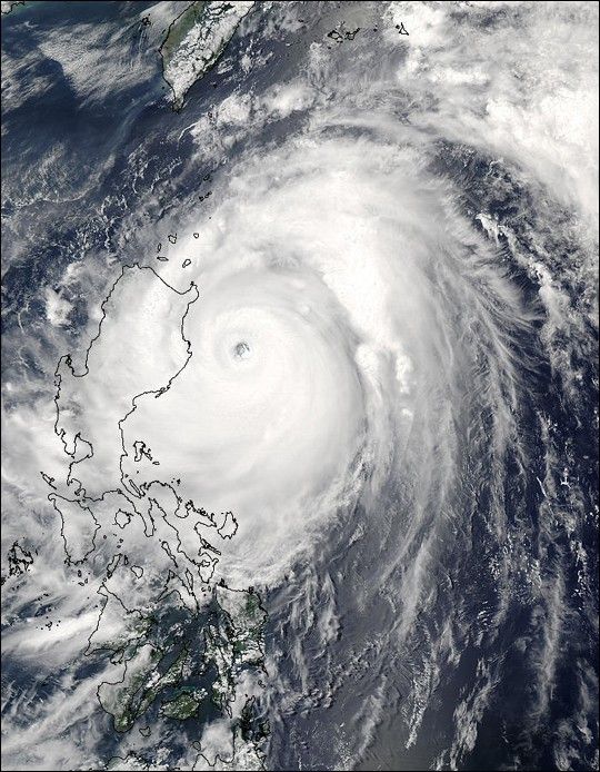
The MODIS instrument onboard NASA’s Aqua satellite captured this true-color image of Super Typhoon Nida churning through the Philippine Islands. Packing winds of 100 mph and gusts of up to 122 mph, the typhoon caused floods and landslides in the Bicol region of the main island of Luzon.Nida has been responsible for at least six deaths in the Philippines and has displaced thousands as it skirted the eastern part of the country before moving towards southern Japan. In addition to the high-resolution image provided above, the image is available in other resolutions.
References & Resources
Image courtesy Jeff Schmaltz, MODIS Land Rapid Response Team at NASA GSFC