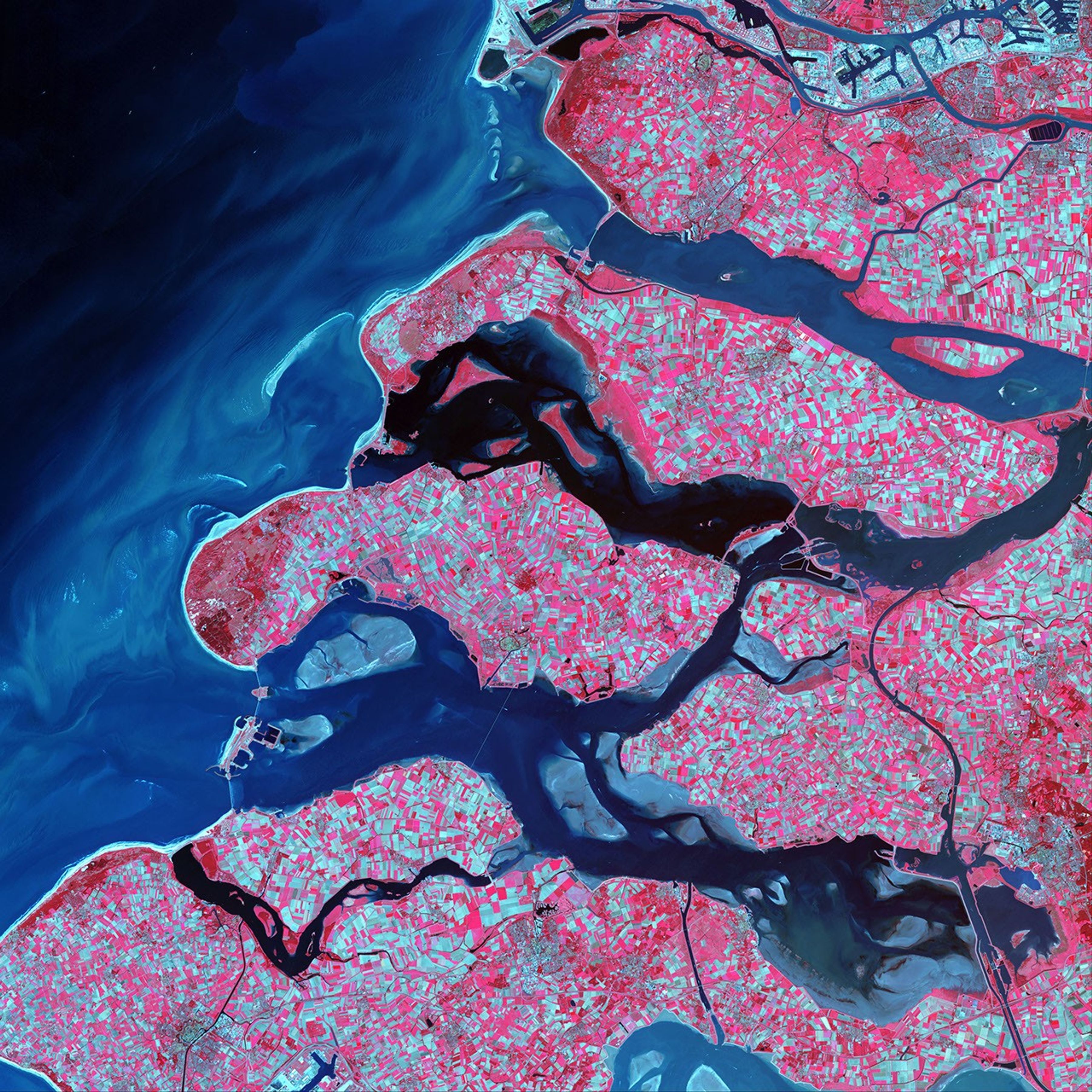
Along the southern coast of the Netherlands, sediment-laden rivers have created amassive delta of islands and waterways in the gaps between the coastal dunes. Afterunusually severe spring tides devasted this region in 1953, the Dutch built anelaborate system of dykes, canals, dams, bridges, and locks to hold back theNorth Sea.
This scene was acquired on May 24, 2002, by the Advanced Spaceborne Thermal Emission and Reflection Radiometer (ASTER) aboard NASA’s Terra satellite. This false-color composite was created by combining infrared,near-infrared, and red (ASTER bands 3, 2, and 1) wavelengths. The darker the red shown here, the more densely vegetated the terrain. The light blue-green areas show bare land surface. The North Sea appears black in this scene and trends from dark blue to lighter blue as the seawater carries increasingly more sediment near the surface.
References & Resources
Image provided by the USGS EROS Data Center Satellite Systems Branch as part of the Earth as Art II image series