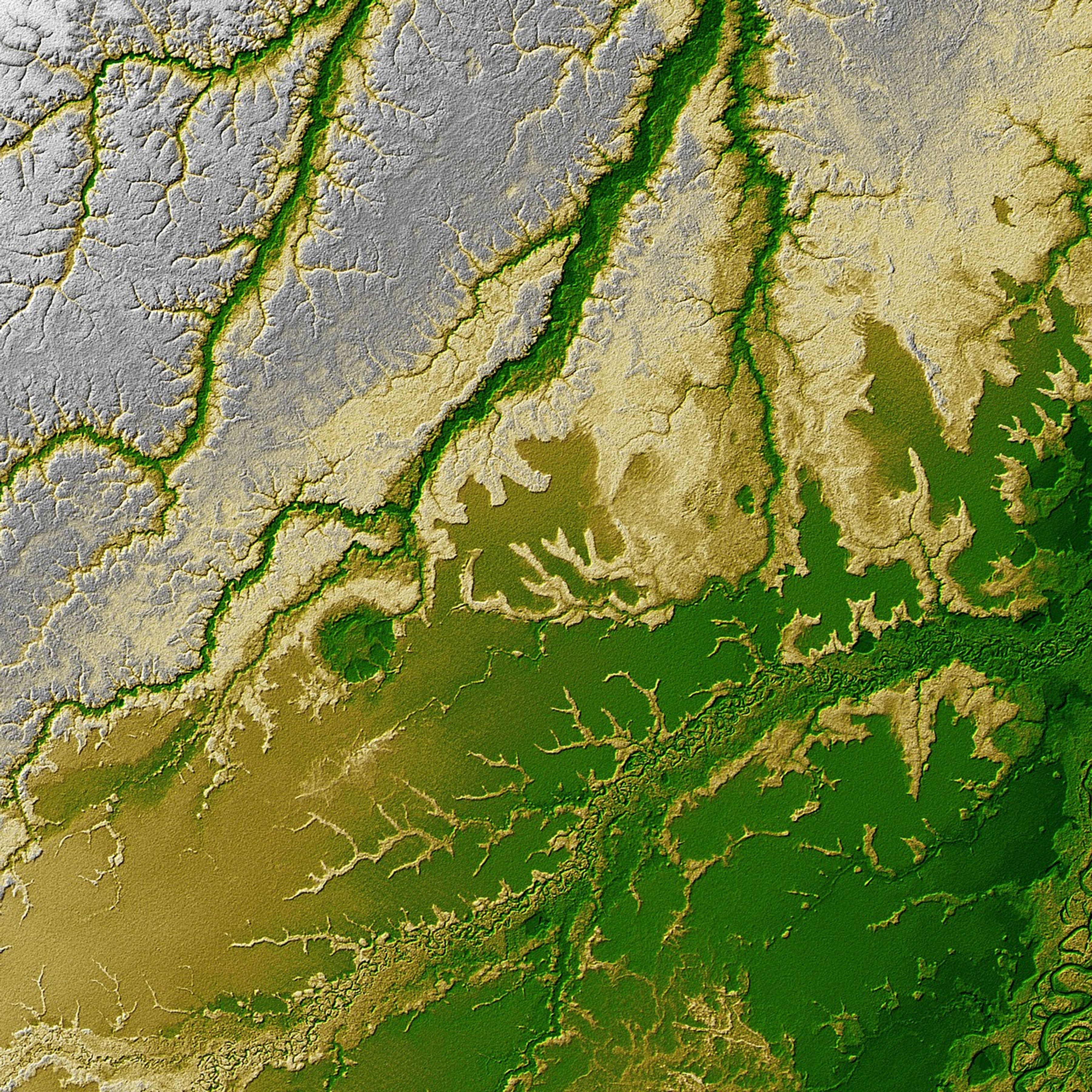
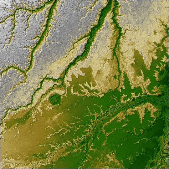
An 8-kilometer (5-mile) wide crater of possible impact origin is shown inthis view of an isolated part of the Bolivian Amazon from the Shuttle RadarTopography Mission (SRTM). The circular feature at the center-left of the image, knownas the Iturralde Structure, is possibly the Earth’s most recent “big” impactevent recording collision with a meteor or comet that might have occurredbetween 11,000 and 30,000 years ago.
Although the structure was identified on satellite photographs in themid-1980s, its location is so remote that it has only been visited by scientificinvestigators twice, most recently by a team from NASA’s Goddard Space FlightCenter in September 2002. Lying in an area of very low relief, the landform is aquasi-circular closed depression only about 20 meters (66 feet) in depth, withsharply defined sub-angular “rim” materials. It resembles a “cookie cutter” in that its appearance “cuts” the heavily vegetated soft-sediments and pampas of this part of Bolivia. The SRTM data have provided investigators with the firsttopographic map of the site and will allow studies of its three-dimensionalstructure crucial to determining whether it actually is of impact origin.
Two visualization methods were combined to produce this image: shading andcolor coding of topographic height. The shade image was derived by computingtopographic slope in the northwest-southeast direction. North-facing slopesappear bright and south-facing slopes appear dark. Color coding is directlyrelated to topographic height, with brown and green at the lower elevations,rising through yellow and brown to white at the highest elevations.
Size: 1 degree latitude by 1 degree longitude (about 111 by 111 kilometers or69 by 69 miles)
Location: 12.5 degrees South latitude, 67.5 degrees West longitude
Orientation: North at top
Image: Elevation data, colored height with shaded relief
Original Data Resolution: SRTM 1 arcsecond (about 30 meters or 98 feet)
Date Acquired: February 2000 (SRTM)
Compare this topographic image with a Landsat image made with spectral (light) information.
References & Resources
Image Courtesy SRTM Team NASA/JPL/NIMA