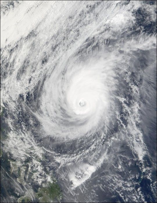
Now downgraded to a tropical depression, Typhoon Mitag can be seen at full strength in this true-color image taken on March 6, 2002, by the Moderate-resolution Imaging Spectroradiometer (MODIS), flying aboard NASA’s Terra spacecraft. The green islands in the lower left-hand corner of the image are the Philippines.
The typhoon, which formed to the south, moved northward late last week and skirted dangerously close to the Philippines before turning northwest and dissipating in the Philippine Sea late this week. On Monday, March 4, 2002, the typhoon bore sustained winds of 160 kilometers (99 miles) per hour and gusts of up to 195 kilometers (121 miles) per hour. On average, roughly 20 tropical storms and typhoons pass through this region of the Pacific Ocean each year.
References & Resources
Image courtesy Jacques Descloitres, MODIS Land Rapid Response Team at NASA GSFC