September 3, 2004
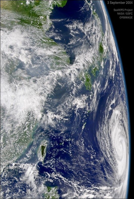
The SeaWiFS instrument aboard the OrbView-2 satellite captured this oblique view of Typhoon Songda on September 3, 2004 at 4:00 UTC. At the time this image was taken Songda was located approximately 834 km (518 miles) east-southeast of Okinawa, Japan and was moving towards the west-northwest at 20 km/hr (13 mph). Maximum sustained winds were near 213 km/hr (132 mph) with gusts to 259 km/hr (161 mph).
References & Resources
Provided by the SeaWiFS Project, NASA/Goddard Space Flight Center, and ORBIMAGE