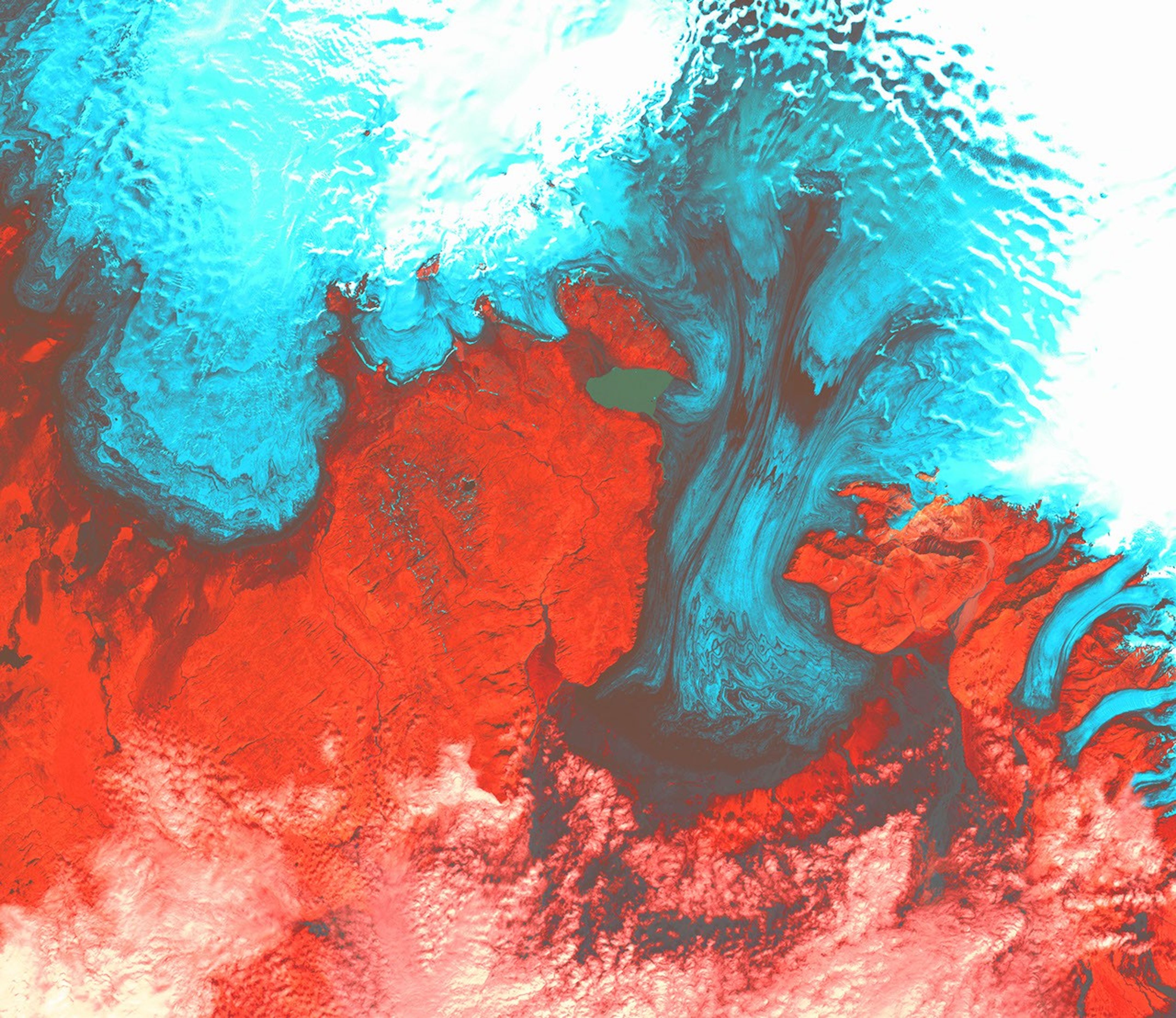

In southeastern Iceland lies the largest glacier in all of Europe: Vatnajökull. In places 400 meters (1,312 feet) thick, the massive glacier covers 8 percent of the entire country. Capping several active volcanoes, Vatnajökull is subject to glacial melt floods when volcanic heat melts portions of the bottom side of the glacier. The water eventually rises above the level of the caldera and spills downward under the pull of gravity.
The stillness of this Landsat image belies such destructive potential. The glacier appears light blue where it is swept clean of snow, but white where covered (top of image). The southern reaches of the great glacier inch southward from Skaftafell National Park and out toward the Atlantic Coast. The glacial tongues that drain the glacier are light blue, and are scalloped by grayish moraines, which are deposits of glacial till (rock debris ground up and carried along by the glacier). Scrubby vegetation over hard, volcanic rock is red.
This image was acquired byLandsat 7’s Enhanced Thematic Mapper plus(ETM+) sensor on August 4, 1999. This is a false-color composite image made using shortwaveinfrared, green, and blue wavelengths. The image has also been sharpened using the sensor’spanchromatic band.
References & Resources
Image provided by the USGS EROS Data Center Satellite Systems Branch. This image is part of the ongoing Landsat Earth as Art series.