
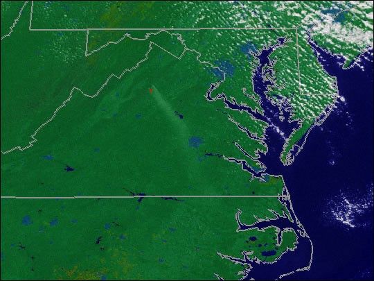
By November 9, 2000, the two fires in Shenandoah National Park near Old Rag Mountain and the PinnaclesPicnic Area had combined into one fire that consumed 20,000 acres. Cool temperature andmoist air helped firefighters contain the fire. Throughout the Southeast, fires inthe fall of 2000 burned over 120,000 acres.
This animation shows smokefrom the Shenandoah fire on November 5, 2000. The red pixels show the areasthat were actively burning. The data were acquired by one of NOAA’s GeostationaryOperational Environmental Satellites (GOES). Current GOES data and images of fires,hurricanes, tornadoes, and other severe weather are provided by NASA’s RemoteSensing Data project.
References & Resources
Image and animation by Marit Jentoft-Nilsen, NASA GSFC
