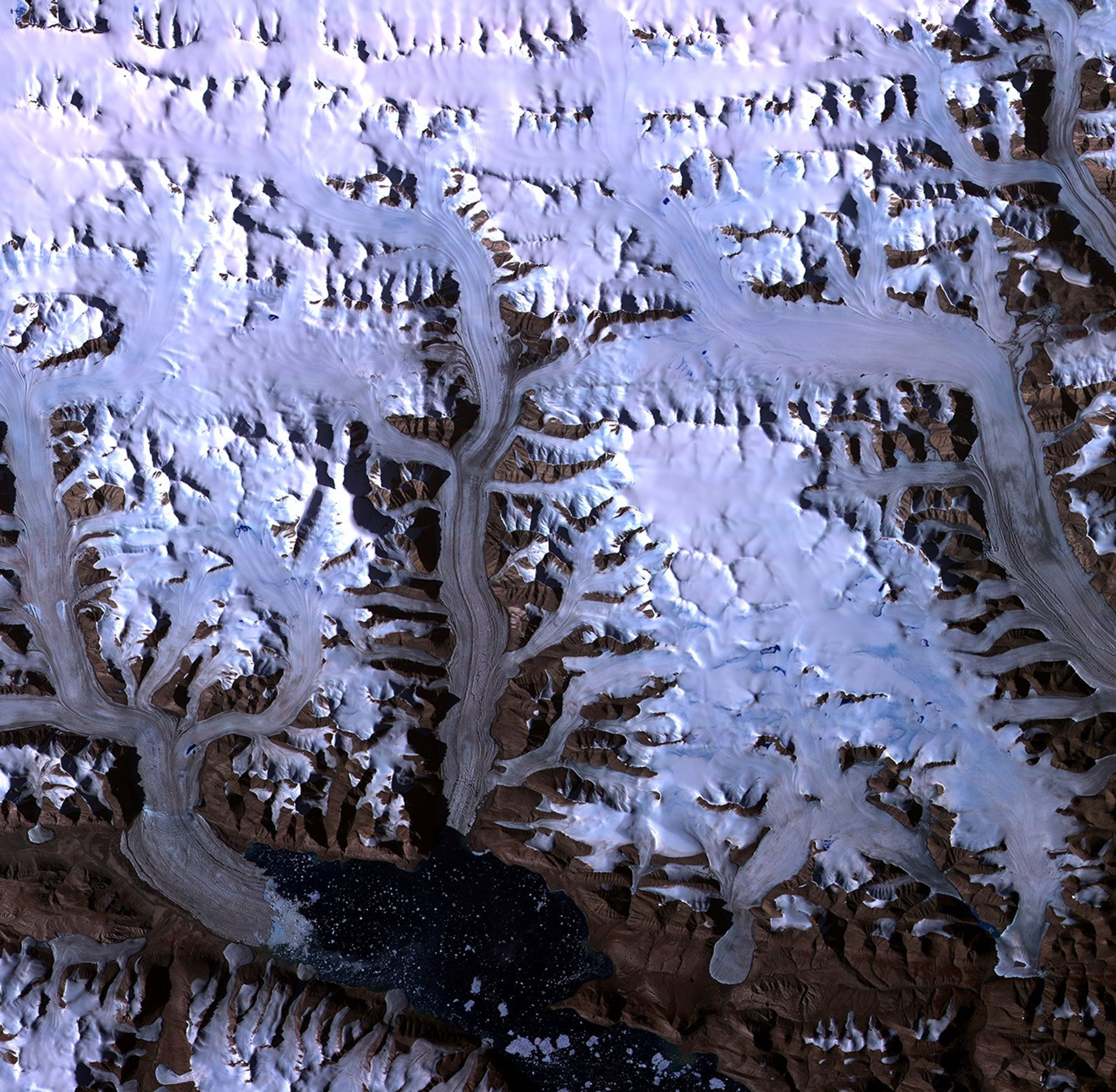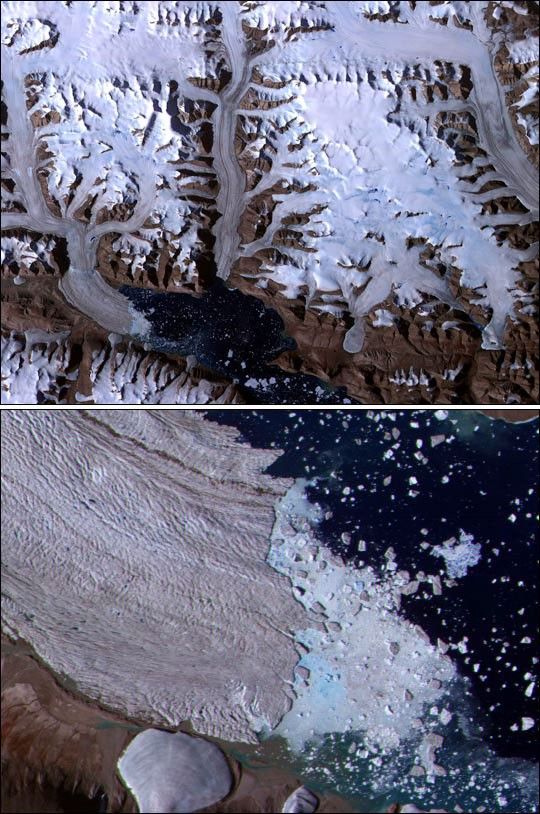
Advanced Spaceborne Thermal Emission and Reflection Radiometer(ASTER) images are being used in an ambitious international project tomap the extent of Earth's glaciers and the rate at which they arechanging. High-resolution ASTER images make it possible to distinguishand track small features on glacier surfaces. Images presented at theAmerican Geophysical Union meeting by Rick Wessels from Arizona StateUniversity showing details of glacial snow and ice are contributing tothe Global Land Ice Measurements from Space (GLIMS) project, a globalconsortium led by the U.S. Geological Survey.
Dobbin Bay is at the bottom of this ASTER image (top) of several glaciersin the Canadian Arctic on Ellesmere Island. The image was taken on July31, 2000.
The detail (bottom image) of the leading edge of the Eugenie Glacier's"floating tongue" reveals surface cracks and extensive calving of icebergs in Dobbin Bay.
References & Resources
Image courtesy University of Alberta and NASA/GSFC/MITI/ERSDAC/JAROS, and U.S./Japan ASTER Science Team