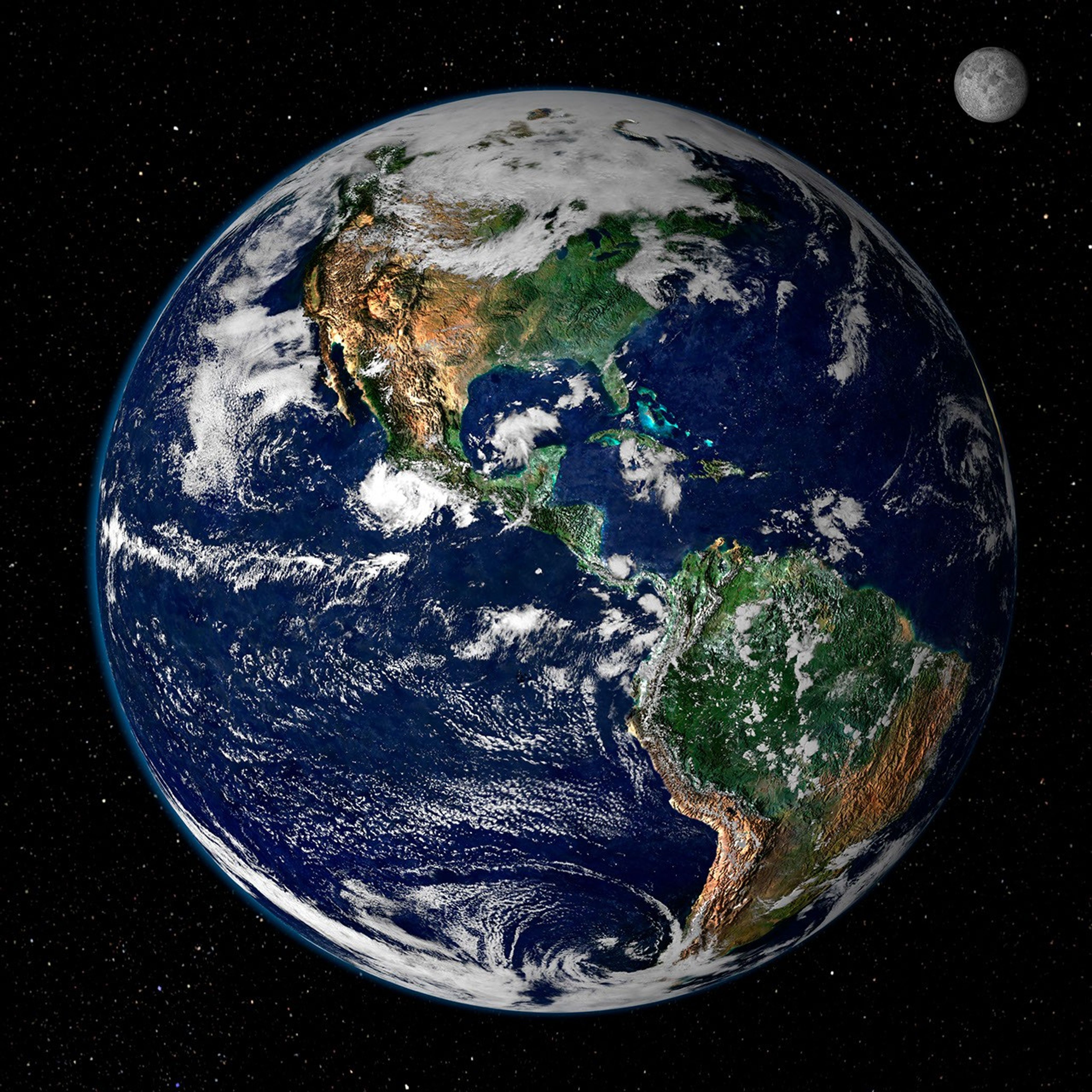

This true-color image shows North and South America as they would appearfrom space 35,000 km (22,000 miles) above the Earth. The imageis a combination of data from two satellites. The ModerateResolution Imaging Spectroradiometer (MODIS) instrument aboardNASA’s Terrasatellite collected the land surface data over 16 days, while NOAA’sGeostationary Operational Environmental Satellite (GOES) produced a snapshotof the Earth’s clouds.
References & Resources
Image created by Reto Stöckli, Nazmi El Saleous, and Marit Jentoft-Nilsen, NASA GSFC