
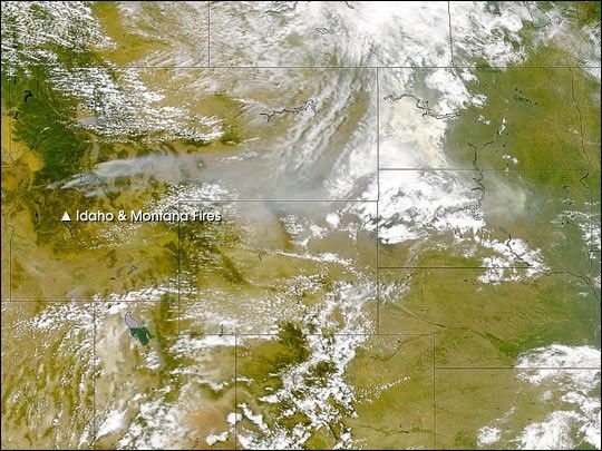
Smoke and flame continue to color the skies over large portions of thewestern United States. Limited rainfall and scorching temperatures havecreated ideal conditions for fires, and weary firefighters are struggling tocombat the blazes.
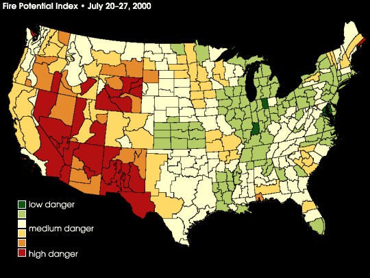
This image shows fire danger around the United States, based on data collectedbetween July 20th and 27th, 2000. (The animation shows a sequence of eight-daymeasurements, running from April 28th to July 27th, 2000.) Red areasindicate where fire potential is greater and green areas show places wherethe threat is lower. This fire potential map is based on the Soil Moisture Index (SMI).SMI is derived from temperature and vegetationmeasurements taken by NOAA's satellite-based Advanced Very High ResolutionRadiometer (AVHRR). SMI data is regularly posted at: http://www.forestry.umt.edu/rsl/smi/smidata.htm
References & Resources
Data provided by the Numerical Terradynamic Simulation Group at the University of Montana. Additional animation by Robert Simmon.
