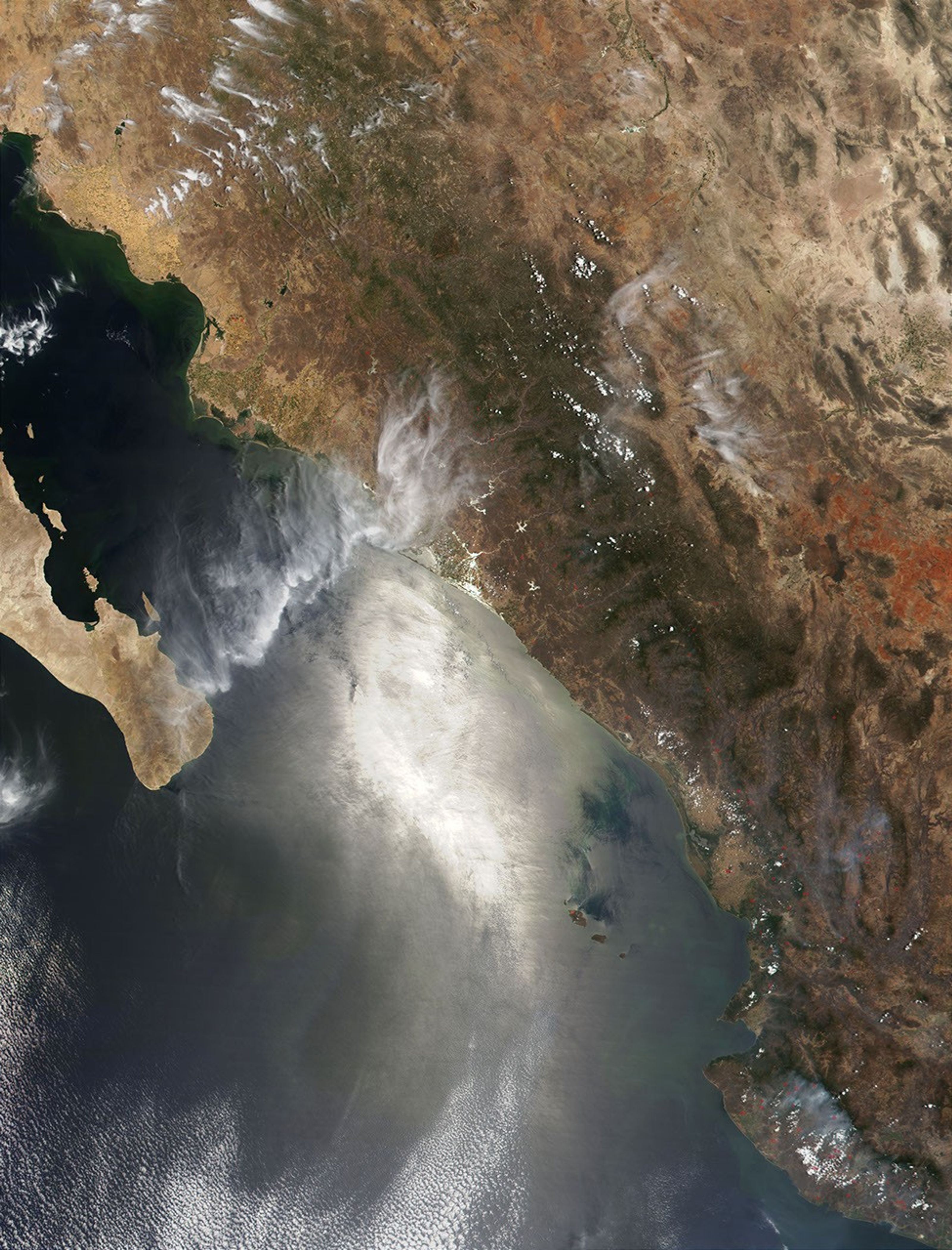

NASA's Terra satellite observed dozens of fires (red pixels) burning inMexico on May 28, 2001. This true-color scene, acquired by theModerate-resolution Imaging Spectroradiometer (MODIS), spans the regionof the southern end of the Baja Peninsula (left), across the Gulf ofCalifornia, and over the Sierra Madre Mountains running southeastwardthrough the Province of Sinaloa (center and lower right).
The green hues show the location of Sinaloa's tropical coniferousforests west of the Sierra Madre Mountains. The climate there issemi-arid and conditions are often ripe this time of year for wildfireoutbreaks.
Other features that can be seen in this image are the city of La Paz,the emerald cluster of pixels located on the southern side of the Bay ofLa Paz, on the southeastern shore of the Baja Peninsula. The famoustourist location of Cabo San Lucas sits at the very southern tip ofBaja. Due east of Cabo San Lucas, across the Gulf of California, thesmall light brown cluster of pixels on the gulf's eastern shore revealsthe location of the city of Mazatlan. The large, bright area on thesurface of the water is due to the reflection of the sun (glint).
Moving northward along the eastern shore of the gulf, there is aconsiderable amount of sediment (perhaps mixed with phytoplankton) inthe water. In the high resolution version of this scene, manyagricultural fields can be seen along this shore to the north.
References & Resources
Image courtesy Jacques Descloitres, MODIS Land Rapid Response Team