
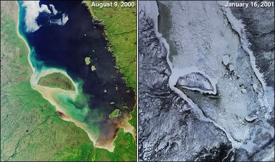
One year ago, in late February 2000, the Multi-angle Imaging Spectroradiometer(MISR) began acquiring Earth imagery.Its “first light” images showed a frozen James Bay in the Ontario-Quebecregion of Canada. These more recent nadir-camera views of the same areailluminate stark contrasts between summer and winter. The left-handimage was acquired on August 9, 2000, and theright-hand image is from January 16, 2001.
James Bay lies at the southern end of Hudson Bay. It is named for theEnglish explorer Thomas James, who first explored the area in 1631 whilesearching for the Northwest Passage. Visible in these images are some ofthe many rivers that flow into the bay; starting at the southern tip andmoving clockwise on the western side are the Harricana, Moose, Albany,and Attawapiskat. The latter enters the bay just to the west of thelarge, crescent-shaped Akimiski Island.
References & Resources
Image courtesy NASA/GSFC/JPL, MISR Team.

