
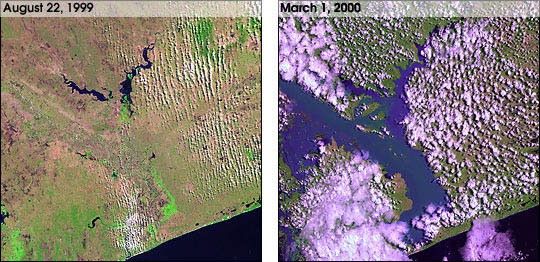
This pair of images from Landsat 7 shows the incredible amount of flooding that is currently occuring in Mozambique. A month of rains and two cyclones caused the Limpopo River to swell to 80km wide in places. At least several hundredpeople have been killed, and over a million have been forced from their homes.
For more background information, see the Landsat 7 fact sheetand Floods: Using Satellites to Keep our Heads Above Water
References & Resources
Image courtesy of Landsat 7 project
None