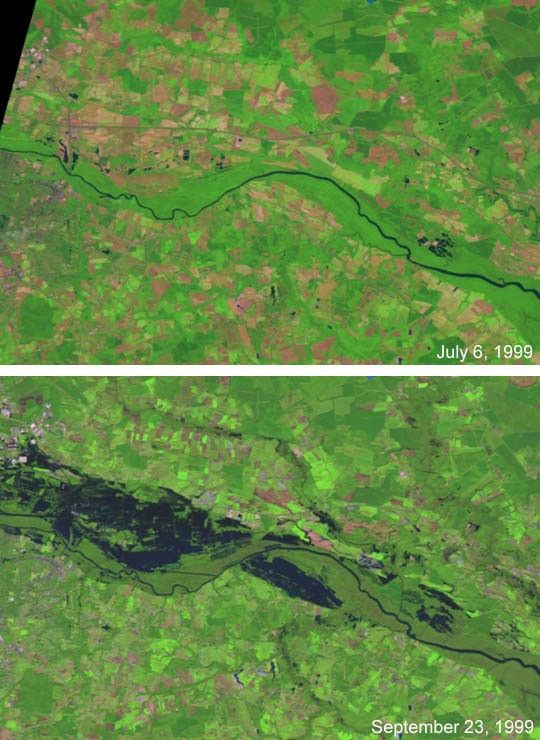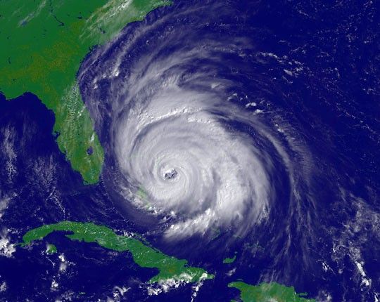
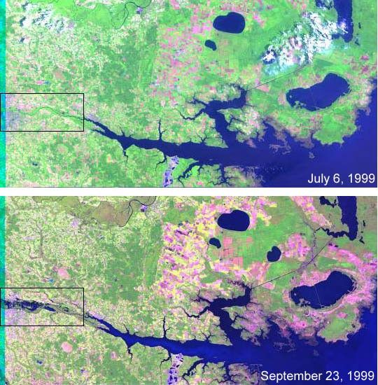
These Landsat 7 images show a region in eastern North Carolina where flooding occurred due to heavy rains brought by Hurricane Floyd. Visiblein the lower lefthand corner of this scene is Washington, NC, where the Tar River meets the Pamlico. This image (click to see higher resolution) wastaken Sept. 23, 1999. Compare it to the image of the same region acquired on July 6, 1999, to see the difference in water level. There is also severe flooding along the Tar River to the northwest of this scene in the towns of Rocky Mount, Tarboro, Princeville, and Greenville. The next opportunity for Landsat 7 to acquire images over these latter towns is Sept. 30, 1999.
References & Resources
Images courtesy of NASA and USGS' EROS Data Center