full-size images:
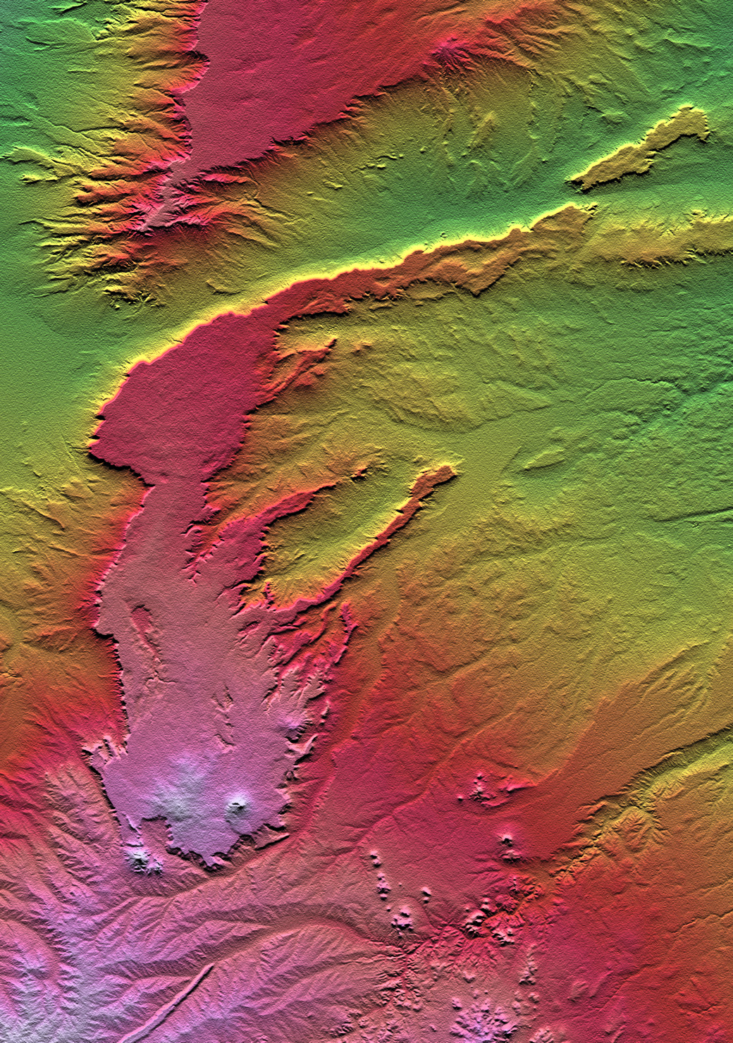
Shaded Relief (1.0 MB)
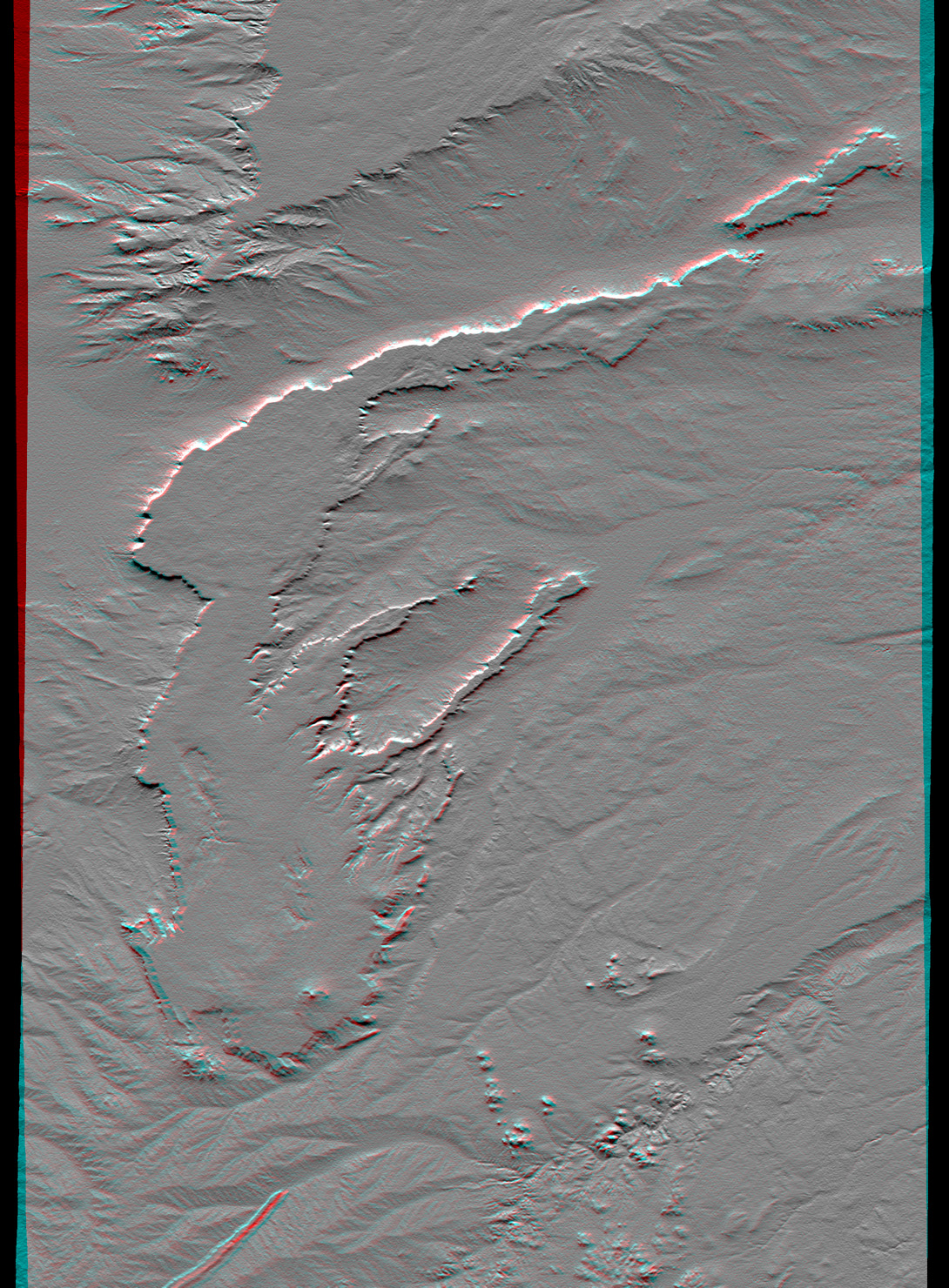
Anaglyph (820 K)
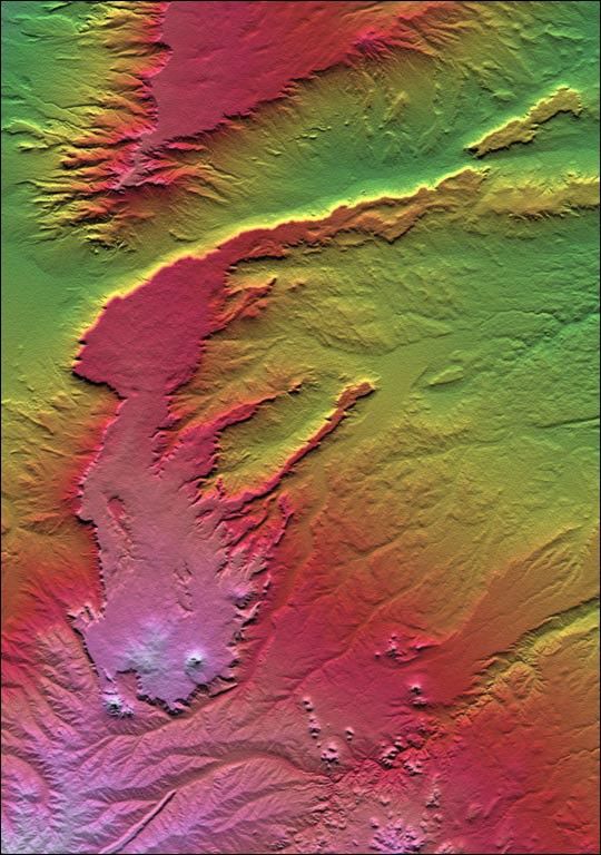
All of the major landforms relate to volcanism and/or erosion in thisShuttleRadar Topography Mission scene of Patagonia, near La Esperanza,Argentina. The two prominent plateaus once formed a continuous surfacethat extended over much of this region. Younger volcanoes have grownthrough and atop the plateau, and one just south of this scene has senta long, narrow flow down a stream channel (lower left). The topographicpattern shows that streams dominate the erosion processes in this aridenvironment even though wind is known to move substantial amounts ofsediment here.
Two visualization methods were combined to produce this image: shadingand color coding of topographic height. The shade image was derived bycomputing topographic slope in the north-south direction. Northernslopes appear bright and southern slopes appear dark, as would be thecase at noon at this latitude in the southern hemisphere. Color-codingis directly related to topographic height, with green at the lowerelevations, rising through yellow, red, and magenta, to white at thehighest elevations.
Size: 62.4 by 88.8 kilometers (38.7 by 55.1 miles)
Location: 40.0 deg. South lat., 68.6 deg. West lon.
Orientation: North toward the top
Image Data: Shaded and colored SRTM elevation model
Date Acquired: February 2000
References & Resources
Image courtesy NASA/JPL/NIMA
None