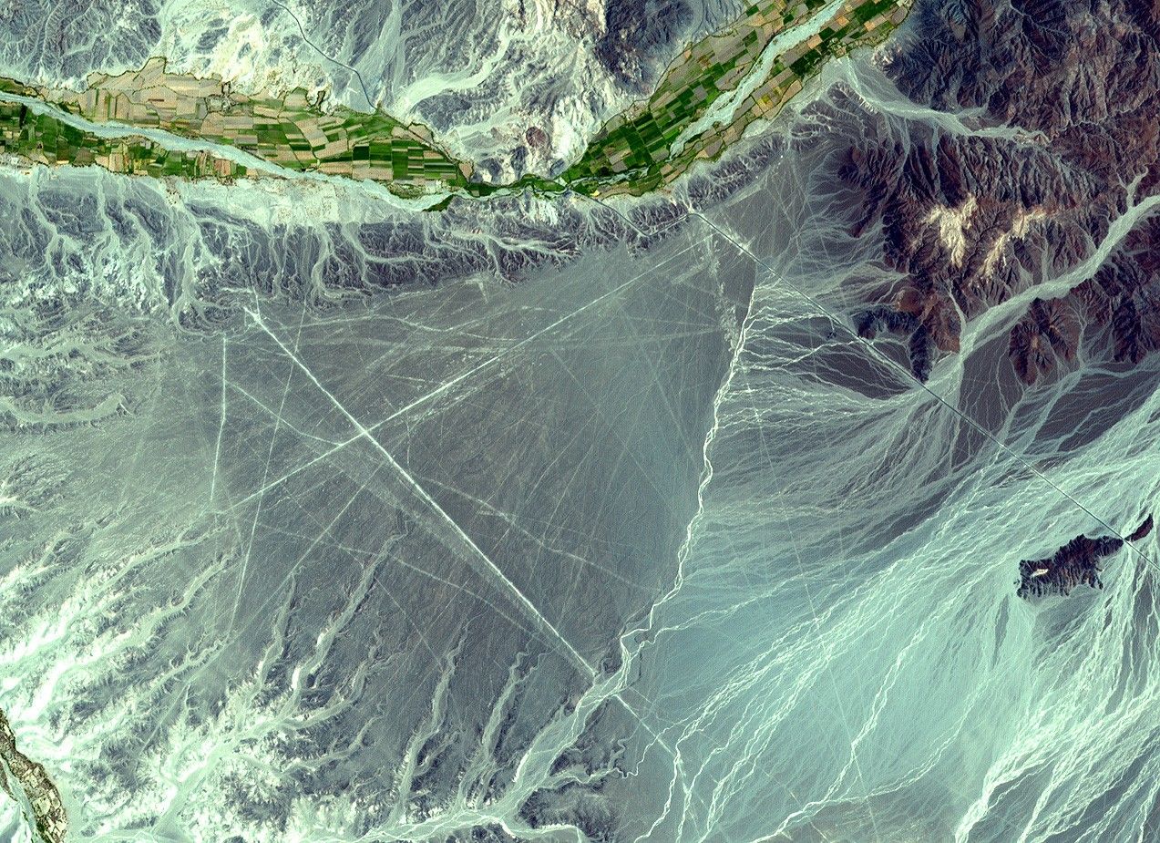
This Advanced Spaceborne Thermal Emission and Reflection Radiometer(ASTER) image, cropped from a full scene, covers an area of 14 x 18 km.ASTER, an instrument aboard NASA’s Terra satellite, acquired the image on December 22, 2000. Visible andinfrared spectral bands were combined to create a simulated true-color image.
The Nasca Lines are located inthe Pampa region of Peru, the desolate plain of the Peruvian coast 400km south of Lima. The Lines were first spotted when commercial airlinesbegan flying across the Peruvian desert in the 1920’s. Passengersreported seeing ‘primitive landing strips’ on the ground below. TheLines were made by removing the iron-oxide coated pebbles which coverthe surface of the desert. When the gravel is removed, they contrastwith the light color underneath. In this way the lines were drawn asfurrows of a lighter color. On the Pampa, south of the Nasca Lines,archaeologists have now uncovered the lost city of the line-builders,Cahuachi. It was built nearly 2,000 years ago and mysteriously abandoned 500 years later.
References & Resources
Image courtesy NASA/GSFC/MITI/ERSDAC/JAROS, and U.S./Japan ASTER Science Team