
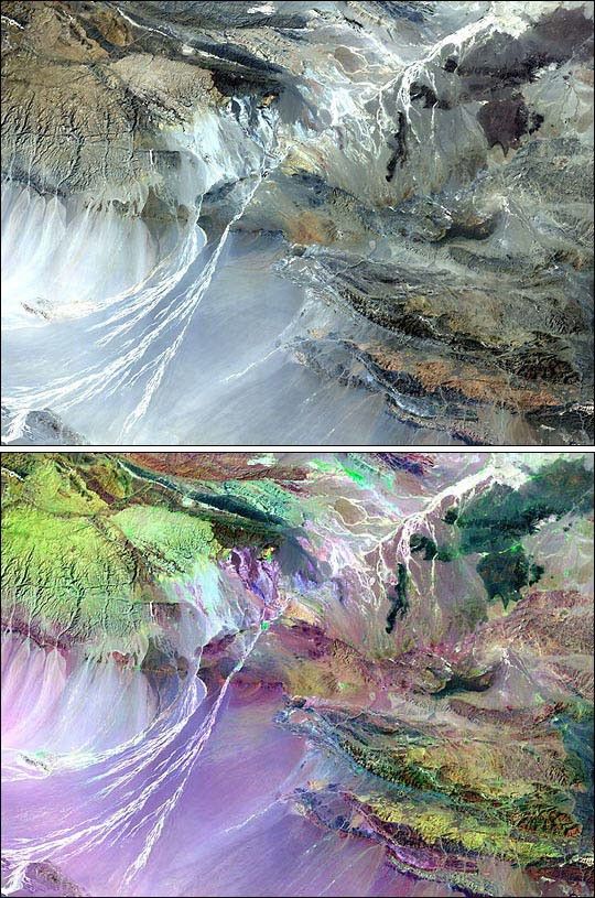
In 1999, an American Museum of Natural History expedition used Landsat images like this one to locate a new site of dinosaur and early mammal fossils in Mongolia's Gobi Desert. With Landsat 5 and 7 data, the scientists can identify areas comprised of sedimentary rocks where vegetation is sparse, requirements for good fossil sites. The high-resolution images also improve upon the poor previously-existing maps of the area.
At the top is a true color Landsat 5 image of the Gobi desert covering the area between Ukhaa Tolgod and the Flaming Cliffs, two of Mongolia's most famous fossil sites.
The bottom image was made by combining Landsat band 7 (shortwave infrared) for red, band 4 (near infrared) for green, and band 1 (blue) for blue. Vegetation and different types of rock and soil stand out clearly in this image, enabling paleontologists to identify favorable rock formations where they are likely to find fossils.
For more information, see Finding Fossils from Space
References & Resources
Images by Barbara Summey, NASA GSFC Visualization Analysis Lab, based on Landsat 5 data provided by the Laboratory for Terrestrial Physics
None